Análise de 13 municípios dos estados de Amazonas e Rondônia aponta alta no desmatamento, aumento da pecuária e avanço sobre terras indígenas
Por Henrique Saunier
O Idesam lançou, no último dia 10, o estudo Análise Ambiental e Socioeconômica dos Municípios Sob Influência da rodovia BR-319. Os dados da publicação – que integra o Projeto BR-319: Acompanhamento e Recomendações – apontam Porto Velho, Lábrea, Manicoré e Autazes como as regiões com a maior quantidade de área desmatada acumulada até o ano de 2016. Somente esses quatro municípios foram responsáveis por 1,7 milhão dos 2,3 milhões de hectares devastados em todas as 13 cidades analisadas. O lançamento do estudo contou com uma rodada de discussão sobre como esse e outros problemas intensificados pela reconstrução da rodovia podem ser minimizados.
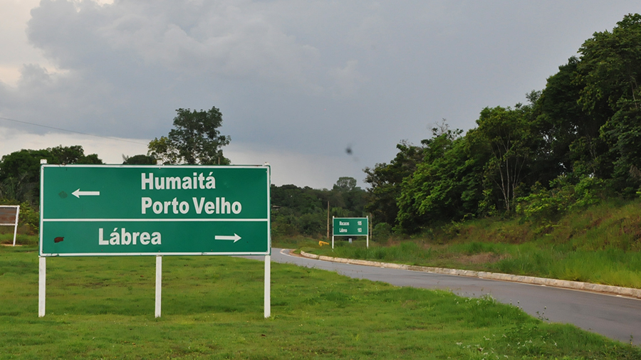
Além dos já citados, Manaus, Careiro da Várzea, Careiro, Manaquiri, Beruri, Borba, Tapauá, Canutama e Humaitá também foram analisados, por estarem diretamente ligados, ou por possuírem alguma estrada com conexão à rodovia, alvo de muitas polêmicas. Segundo o estudo, o intervalo mais controverso da rodovia BR-319 é o chamado “trecho do meio”, que fica entre os quilômetros 250 e 656 e está sujeito a licenciamento ambiental, por necessitar de uma reconstrução total do pavimento.
A perda e degradação de habitat, poluição química, aumento da violência e atropelamentos de fauna foram alguns dos impactos negativos decorrentes da construção de estradas na Amazônia apresentados no lançamento do estudo, que destaca também a invasão antrópica como outro fator preocupante.
Este tópico ganha atenção especial na análise, visto que a invasão antrópica causada pela expansão rodoviária na Amazônia Legal vem acompanhada de graves problemas fundiários que propiciam a ocupação desordenada, a grilagem de terras, os conflitos e expulsão de populações tradicionais.
Uma das autoras do estudo, a coordenadora de políticas públicas do Idesam, Fernanda Meirelles, destaca que o documento traz conclusões que servem de alerta de que é preciso aumentar a governança nestes territórios, intensificar a atuação dos órgãos públicos e maior participação da sociedade civil em toda a discussão.
“Nessas áreas (destacadas no estudo) a ocupação está acontecendo de forma acelerada e o desmatamento crescendo numa velocidade muito grande. É importante que a regularização fundiária ambiental aconteça. A gente identificou muitas sobreposições de áreas declaradas do CAR (Cadastro Ambiental Rural) em Unidades de Conservação (UCs) e isso é muito problemático. É preciso uma checagem em campo dessas áreas declaradas, porque elas invadem terras indígenas e estão dentro das UCs”, alerta Meirelles.
Na análise específica da evolução do desmatamento, foram utilizados dados do Prodes (Projeto de Monitoramento do Desmatamento na Amazônia Legal por Satélite) a fim de contabilizar o desmatamento acumulado desde o ano 2000. Além disso, foram selecionadas áreas consideradas vulneráveis mediante a pavimentação da rodovia, e que foram analisadas separadamente, como é o caso da Vila de Realidade, pertencente ao município de Humaitá.
Um dos participantes da roda de discussão no evento foi o analista de projetos e pesquisa da Fundação Vitória Amazônica (FVA) Marcelo Santos, que destacou o impacto da rodovia federal não apenas no interior, mas também na Região Metropolitana de Manaus. “No caso da BR-319, consideramos críticos os locais onde serão construídas as estradas planejadas, o que configura uma nova via de acesso facilitada para áreas de floresta ainda intactas. Outros pontos (críticos) são Careiro e Humaitá, esta última em uma região ecologicamente importante de campinas amazônicas”, afirma Santos.
Participaram da mesa redonda Jolemia Cristina das Chagas (Casa do Rio), o deputado estadual Luiz Castro (Caama/Aleam), Marcelo Santos (FVA), Paulo Graça (Inpa) e Luciana Valente (MPF-AM). O lançamento foi realizado no Bosque da Ciência e o estudo já está disponível na íntegra neste link.
Desenvolvimento Social
Para entender os impactos da pavimentação da rodovia nesses municípios, os pesquisadores do Idesam analisaram não somente a dinâmica de desmatamento ao longo dos anos, mas também a evolução de indicadores socioeconômicos (como PIB e IDH), o ordenamento territorial, a infraestrutura e o uso da terra e produção rural de cada um deles.
Nesta análise, estão inseridas questões como o acesso a cuidados médicos básicos, água e saneamento, moradia, segurança, sustentabilidade dos ecossistemas, educação superior, entre outros fatores que comprovam o impacto social da rodovia.
Em 1991 — ano inicial da base de dados analisada — todos os municípios, com exceção de Manaus e Porto Velho, se encontravam com um IDH (Índice de Desenvolvimento Humano) muito baixo. Em 2010, todos saíram dessa classificação subindo para as categorias de baixo a alto. Houve uma grande evolução no IDH desses municípios, com aumentos de 42% a 233%, nos vinte anos de análise. Os Estados do Amazonas e Rondônia e o Brasil aumentaram seu IDH em 57%, 70% e 48%, respectivamente, de 1991 a 2010.
Por outro lado, esses municípios apresentaram altos valores para o índice de Gini no intervalo analisado, o que significa uma alta desigualdade na distribuição de renda. De 1991 a 2010, esta desigualdade aumentou para nove dos 13 municípios. No mesmo período, o índice de Gini diminuiu 4,6% para o Brasil e 7,6% para Rondônia. A região Norte se manteve estável e o Estado do Amazonas aumentou em 7,6%.
O pesquisador sênior do Idesam, Mariano Cenamo, destaca que a análise deixa claro que o impacto da estrada já existe, independente do seu asfaltamento ou não. De acordo com Cenamo, isso pode ser constatado na região sul do Amazonas, onde há uma ocupação muito forte e um processo intensificado de comercialização de terras.
O estudo aponta que municípios com piores pontuações, Lábrea e Tapauá, ainda enfrentam problemas relacionados à ausência de acesso ao ensino básico e educação superior, aos serviços de nutrição e cuidados médicos básicos, além de abastecimento precário de água.[:en]Analysis of 13 municipalities in the states of Amazonas and Rondônia shows rise of deforestation, increase of cattle ranching and the trespass onto indigenous lands
By Henrique Saunier
Translated by Felipe Sá
On May 10th, Idesam launched the study “Environmental and Socioeconomic Analysis of Municipalities Under Influence of BR-319 highway” (‘Análise Ambiental e Socioeconômica dos Municípios Sob Influência da rodovia BR-319’, in Portuguese). Data from the publication – which integrates Project BR-319: Monitoring and Recommendations – points to Porto Velho, Lábrea, Manicoré and Autazes as the regions with the largest amount of deforested area accumulated until the year 2016. Only these four municipalities were responsible for 1.7 million of the 2.3 million hectares devastated in all 13 cities analyzed. The launch of the study featured a round of discussion on how this and other problems intensified by the road reconstruction can be minimized.
In addition to those already mentioned, Manaus, Careiro da Várzea, Careiro, Manaquiri, Beruri, Borba, Tapauá, Canutama and Humaitá were also analyzed because they are directly linked or because they have some road with connection to the highway – the target of many controversies. According to the study, the most controversial piece of the BR-319 highway is the so-called “middle stretch”, which is located between kilometers 250 and 656 and is subject to environmental licensing, as it requires a total reconstruction of the pavement.
The loss and degradation of habitat, chemical pollution, increased violence and trampling of fauna were some of the negative impacts resulting from the construction of roads in the Amazon presented at the launch of the study, which also highlights the human invasion as another worrying factor.
This topic gains special attention in the analysis, since the anthropic invasion caused by the road expansion in the Legal Amazon is accompanied by serious land problems that lead to disorderly occupation, deed-falsifying (‘grilagem’, in Portuguese), conflicts and expulsion of traditional populations.
One of the authors of the study, Idesam’s public policy coordinator, Fernanda Meirelles, points out that the document draws conclusions that point to the need to increase governance in these territories, intensify the performance of public agencies and greater participation of civil society in this discussion as a whole.
“In these areas (highlighted in the study), occupation is occurring rapidly and deforestation is growing at a very high rate. It is important that environmental land regularization happens. We have identified many overlaps of declared CAR (Rural Environmental Cadastre) areas in Conservation Units (UCs, in Portuguese) and this is very problematic. It requires a field check of these declared areas, because they invade indigenous lands and are inside the UCs”, Meirelles warns.
In the specific analysis of the evolution of deforestation, data from Prodes (Deforestation Monitoring Project in the Legal Amazon by Satellite) were used to account for accumulated deforestation since the year 2000. In addition, areas considered vulnerable due to the highway paving were selected and analyzed separately, as is the case of Vila de Realidade, that belongs to the municipality of Humaitá.
One of the participants in the discussion was the project and research analyst of the Vitória Amazônica Foundation (FVA) Marcelo Santos, who highlighted the impact of the federal highway not only in the interior, but also in the Metropolitan Region of Manaus. “In the case of the BR-319, we consider critical the locations where the planned roads will be built, which constitutes a new facilitated access route to areas of still intact forest. Other (critical) points are Careiro and Humaitá, the latter in an ecologically important region of Amazonian meadows”, says Santos.
Jolemia Cristina das Chagas (‘Casa do Rio’), Luiz Castro (Caama/Aleam), Marcelo Santos (FVA), Paulo Graça (Inpa) and Luciana Valente (MPF-AM) participated in the roundtable. The launch was held at ‘Bosque da Ciência’ and the study is already available in this link.
Social Development
In order to understand the impacts of road paving in these municipalities, Idesam’s researchers analyzed not only the dynamics of deforestation over the years, but also the evolution of socioeconomic indicators (such as GDP and HDI), land planning, infrastructure and use of the land and rural production of each of them.
In this analysis, issues such as access to basic medical care, water and sanitation, housing, safety, ecosystem sustainability, higher education, among other factors that confirm the social impact of the highway are included.
In 1991 – the initial year of the database analyzed – all municipalities, with the exception of Manaus and Porto Velho, had a very low Human Development Index (HDI). In 2010, all went out of this classification going up into the categories from low to high. There was a great evolution in the HDI of these municipalities, with increases of 42% to 233% in the twenty years of analysis. The states of Amazonas and Rondônia and Brazil increased their HDI by 57%, 70% and 48%, respectively, from 1991 to 2010.
On the other hand, these municipalities presented high values for the Gini index in the interval analyzed, which means a high inequality in the distribution of income. From 1991 to 2010, this inequality increased to nine of the 13 municipalities. In the same period, the Gini index decreased 4.6% for Brazil and 7.6% for Rondônia. The North region remained stable and the State of Amazonas increased by 7.6%.
Idesam’s senior researcher, Mariano Cenamo, points out that the analysis makes clear that the impact of the road already exists, regardless of whether or not it is paved. According to Cenamo, this can be seen in the southern region of Amazonas, where there is a very strong occupation and an intensified land marketing process.
The study points out that municipalities with worse scores, Lábrea and Tapauá, still face problems related to the lack of access to basic and higher education, nutrition services and basic medical care, as well as precarious water supply.